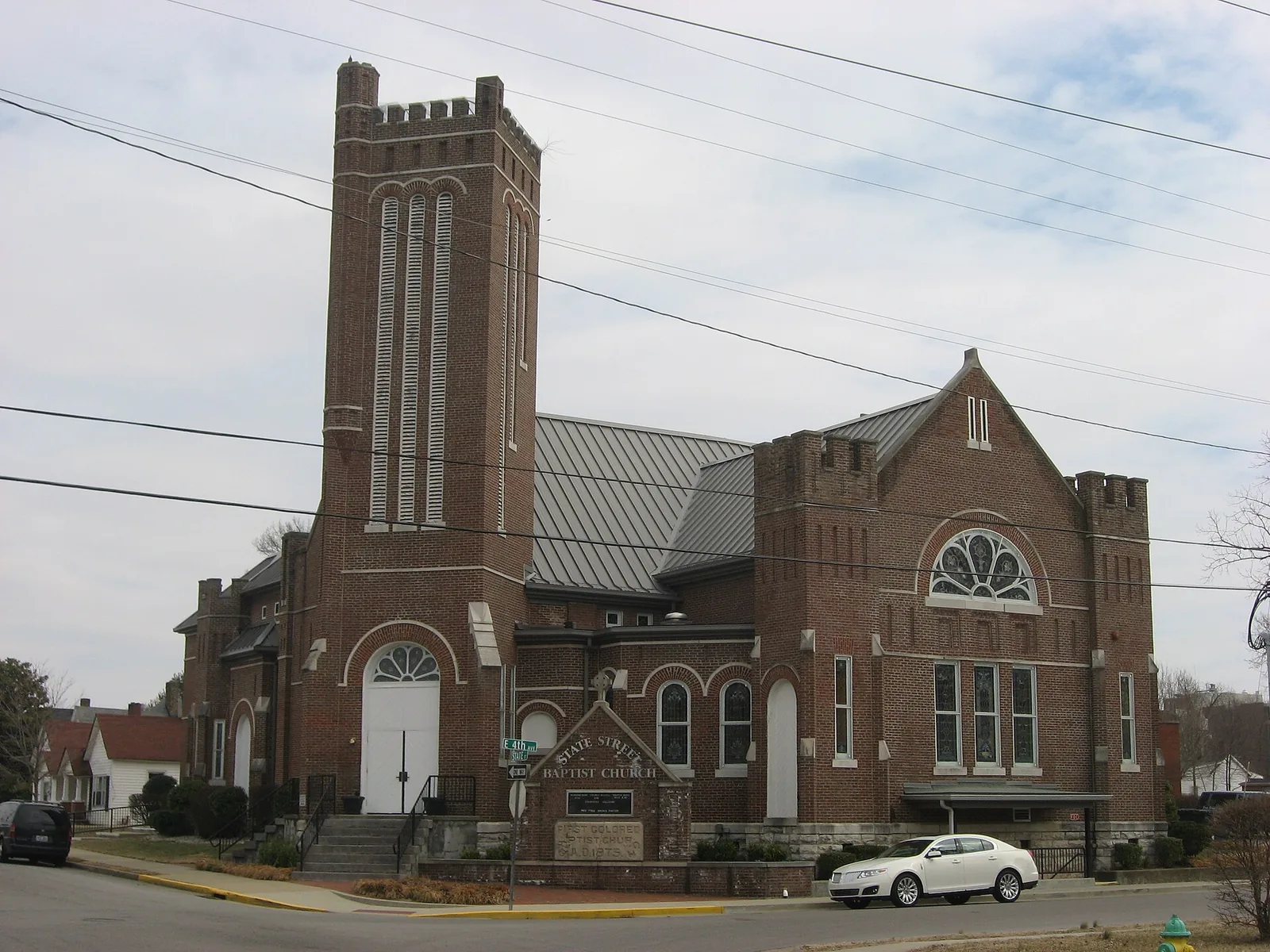
Shake Rag, north of downtown Bowling Green in ZIP code 42101, was the city's first National Register district honored for African American history.
Last checked Oct. 16, 2026. Sources: the National Park Service’s National Register listing, the Focus 2030 comprehensive plan of the City-County Planning Commission (270-842-1953), the city’s school zone map, the Kentucky School Report Card, the Zillow Home Value Index, Bowling Green Parks & Recreation and OpenStreetMap.
Shake Rag is the historic neighborhood along the north end of State Street, on the north side of downtown. Visit Bowling Green calls it the city’s first National Register district recognized for its significance to African American history.
What this means for you
- Schools: Bowling Green Independent Schools: T.C. Cherry Elementary for almost all of the district, then Bowling Green Junior High and Bowling Green High School.
- Home value: Zillow’s typical value in ZIP code 42101 was $234,091 in September 2026.
- Interstate: the nearest I-65 interchange is Exit 26 (KY 234, Cemetery Road), about 3 miles east on the map.
Where it is
The Shake Rag Historic District was listed on the National Register of Historic Places in 2000. The listing describes it as roughly bounded by the U.S. 31-W Bypass, Chestnut Street, East Fifth Avenue and College Street. It is inside the city limits and in ZIP code 42101, according to the Census Bureau’s ZIP code areas.
The Warren County and Bowling Green comprehensive plan, Focus 2030, makes revitalizing Shake Rag a priority (Action HN-3.2). It lists housing repairs, streetscape work, new homes on empty lots, moving overhead utility lines, and a “heritage walk” from Fountain Square to the Barren Riverfront.
Schools
Shake Rag is in Bowling Green Independent Schools (270-746-2200). On the city’s school zone map, almost the whole district is in the T.C. Cherry Elementary zone; one edge is in the Parker-Bennett-Curry zone. Check your own address.
| School | Grades | 2024-25 rating |
|---|---|---|
| T.C. Cherry Elementary | K-5 | Yellow (medium) |
| Parker-Bennett-Curry (one edge) | K-5 | Orange (low) |
| Bowling Green Junior High | 6-8 | Green (high) |
| Bowling Green High | 9-12 | Green (high) |
Ratings are the overall color in the Kentucky Department of Education’s 2024-25 accountability file, from red (lowest) through orange, yellow and green to blue (highest). More in our schools guide.
Home values
Zillow’s Home Value Index for ZIP code 42101 was $234,091 in September 2026, up 0.2% from $233,593 in September 2025, according to the Zillow Home Value Index (Zillow Research). The citywide figure was $280,339. The index is a modeled typical value for the middle third of homes across the ZIP code, not a sale price. More in home prices.
Parks
- Circus Square Park, 621 State St., 4.6 acres.
- Lee Square Playground, 225 State St.
- Roland Bland Park, 401 Center St., 6.25 acres, with the skate park.
- Kummer/Little Recreation Center, 333 College St.
- Mitch McConnell Park “Riverwalk”, 426 E. Riverview Drive, 71.7 acres along the Barren River, about a third of a mile away.
More in parks and trails and history and landmarks.
Getting around
- Downtown: Fountain Square is about 0.8 mile away by road, measured on the OpenStreetMap road network.
- I-65: Exit 26 (KY 234, Cemetery Road) is the nearest interchange, about 3 miles east as the crow flies (exit numbers from OpenStreetMap).
- Nashville International Airport in Nashville, Tennessee, is about 75 miles away by road. That is a distance, not a drive time.
- Buses: GoBG Transit’s route map lists stops on State Street at East Seventh Avenue (post office), East Sixth Avenue by the skate park, East Second Avenue at State Street and College Street at the Kummer/Little Recreation Center. Call 270-393-3695, or see getting around.
Groceries and everyday stores
- Kroger, with a pharmacy, 350 U.S. 31-W Bypass, about half a mile away, according to OpenStreetMap.
- CVS Pharmacy, Kentucky Street, a little over a mile away.
More neighborhoods
Shake Rag is one of the areas in our Bowling Green neighborhoods guide. Next door: downtown and Upper East Main.
Map data © OpenStreetMap contributors.
Frequently asked questions
Where is Shake Rag in Bowling Green?
The Shake Rag Historic District is roughly bounded by the U.S. 31-W Bypass, Chestnut Street, East Fifth Avenue and College Street, on the north side of downtown, according to its National Register listing.
Why is Shake Rag historic?
Shake Rag was listed on the National Register of Historic Places in 2000. Visit Bowling Green calls it the city’s first National Register district recognized for its significance to African American history.
What schools serve Shake Rag?
Shake Rag is in Bowling Green Independent Schools. The city’s zone map puts almost all of it in the T.C. Cherry Elementary zone; older students go to Bowling Green Junior High and Bowling Green High.
What parks are in Shake Rag?
The nearest city parks are Circus Square Park, 621 State St., Lee Square Playground, 225 State St., and Roland Bland Park, 401 Center St., all within about a quarter mile of the district on the map.
Have your say