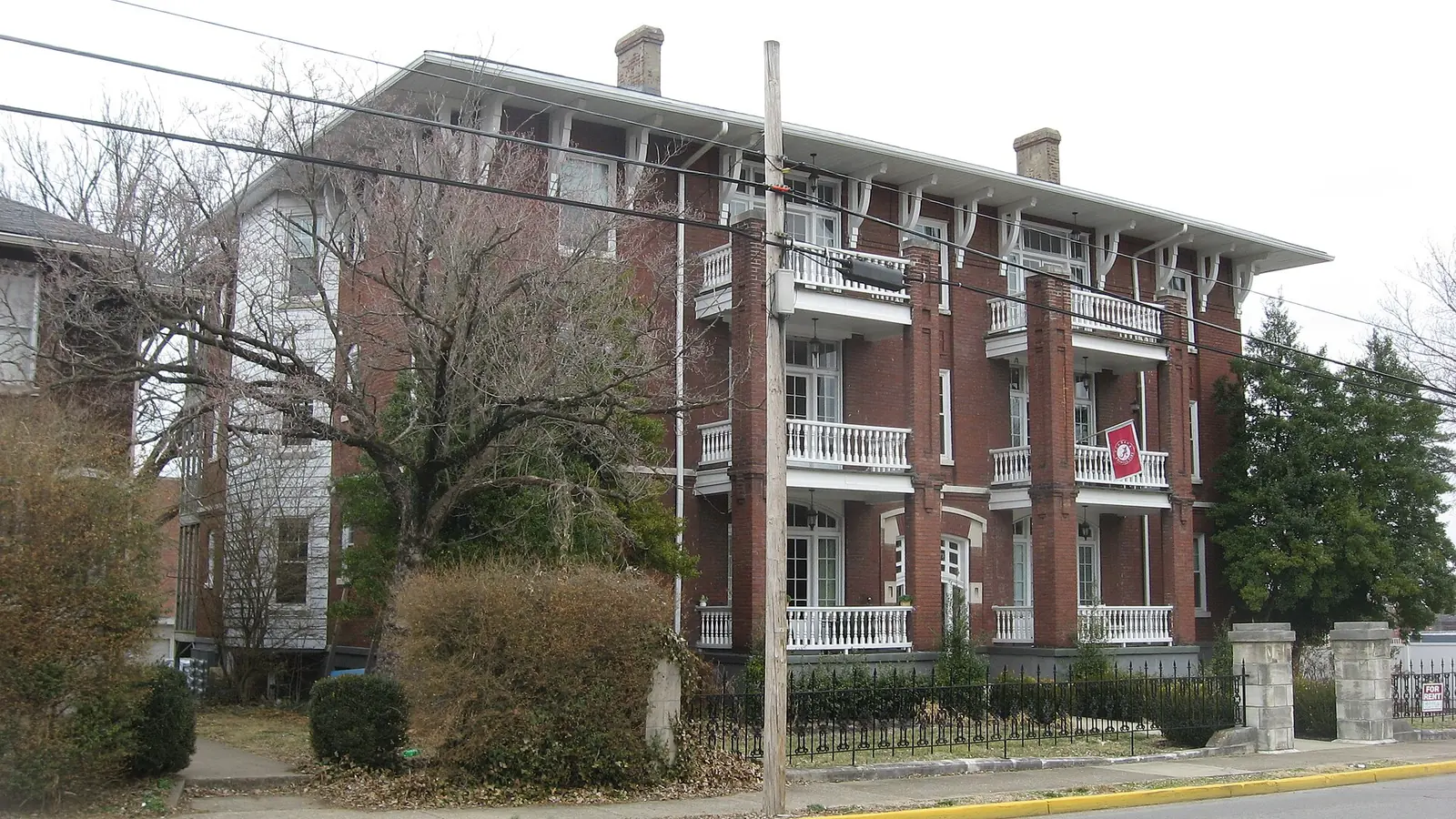
College Hill sits between downtown and WKU in ZIP code 42101. It is zoned for T.C. Cherry Elementary and Bowling Green High School.
Last checked Oct. 16, 2026. Sources: the National Park Service’s National Register listing, the City-County Planning Commission (270-842-1953), the city’s school zone map and neighborhood groups list, the Kentucky School Report Card, the Zillow Home Value Index, Bowling Green Parks & Recreation and OpenStreetMap.
College Hill is the residential slope between downtown Bowling Green and the main campus of Western Kentucky University. Its late 19th and early 20th century streets are a historic district on both the national and the local lists.
What this means for you
- Schools: Bowling Green Independent Schools: T.C. Cherry Elementary, Bowling Green Junior High and Bowling Green High School.
- Home value: Zillow’s typical value in ZIP code 42101 was $234,091 in September 2026.
- Interstate: the nearest I-65 interchange is Exit 26 (KY 234, Cemetery Road), about 3 miles east on the map.
Where it is
The College Hill District was listed on the National Register of Historic Places on Dec. 18, 1979, and enlarged in 1995. The listing describes it as roughly bounded by College and Chestnut streets and 11th and 15th avenues. Visit Bowling Green’s historic districts page calls it one of four late 19th and early 20th century residential districts in the city, and says walking tour brochures are available.
The City-County Planning Commission’s historic districts map also shows a College Hill local district. If you plan to change the outside of a house, call the commission at 270-842-1953 first. The city’s neighborhood groups list includes the College Hill Neighborhood Association.
The area is inside the city limits and in ZIP code 42101, according to the Census Bureau’s ZIP code areas. Its main streets are College Street, State Street, Chestnut Street and the numbered avenues.
Schools
College Hill is in Bowling Green Independent Schools (270-746-2200). On the city’s school zone map, almost all of it is in the T.C. Cherry Elementary zone; the northwest corner touches the Parker-Bennett-Curry zone, so check your own address.
| School | Grades | 2024-25 rating |
|---|---|---|
| T.C. Cherry Elementary | K-5 | Yellow (medium) |
| Bowling Green Junior High | 6-8 | Green (high) |
| Bowling Green High | 9-12 | Green (high) |
Ratings are the overall color in the Kentucky Department of Education’s 2024-25 accountability file, from red (lowest) through orange, yellow and green to blue (highest). Calendars and contacts are in our schools guide.
Home values
Zillow’s Home Value Index for ZIP code 42101 was $234,091 in September 2026, up 0.2% from $233,593 in September 2025, according to the Zillow Home Value Index (Zillow Research). The citywide figure was $280,339. The index is a modeled typical value for the middle third of homes in the whole ZIP code, not a sale price. More in home prices.
Parks
- Ogden Park, 1600 Park St., just under an acre, about half a mile from the middle of the district.
- Fort C.F. Smith Park at Historic Reservoir Hill, 900 E. Main Ave., 5 acres.
- Fountain Square Park, downtown, less than half a mile north.
More in parks and trails and walking and biking trails.
Getting around
- Downtown: Fountain Square is about 0.6 mile away by road, measured on the OpenStreetMap road network.
- I-65: Exit 26 (KY 234, Cemetery Road) is the nearest interchange, about 3 miles east as the crow flies (exit numbers from OpenStreetMap).
- Nashville International Airport in Nashville, Tennessee, is about 73 miles away by road. That is a distance, not a drive time.
- Buses: GoBG Transit’s route map lists stops on East 12th Avenue at College Street, by the library and Bowling Green Towers, and on East 12th Avenue at Chestnut Street. Call 270-393-3695, or see getting around.
Groceries and everyday stores
- CVS Pharmacy, Kentucky Street, less than half a mile away, according to OpenStreetMap.
- Warren County Public Library, 1225 State St., inside the neighborhood.
- The nearest supermarket on OpenStreetMap is Kroger, 350 U.S. 31-W Bypass, about 1.3 miles away.
More neighborhoods
College Hill is one of the areas in our Bowling Green neighborhoods guide. Next door: downtown and Upper East Main.
Map data © OpenStreetMap contributors.
Frequently asked questions
Where is College Hill in Bowling Green?
The College Hill District, on the National Register of Historic Places since 1979, is roughly bounded by College and Chestnut streets and 11th and 15th avenues, between downtown and Western Kentucky University.
What schools serve College Hill in Bowling Green?
College Hill is in Bowling Green Independent Schools. The city’s zone map puts almost all of it in the T.C. Cherry Elementary zone; older students go to Bowling Green Junior High and Bowling Green High, both rated green (high) for 2024-25.
What is the typical home value in College Hill?
College Hill is in ZIP code 42101, where Zillow’s Home Value Index was $234,091 in September 2026, up 0.2% on the year. It is a modeled typical value, not a sale price.
Is College Hill a good place to live?
College Hill is a National Register and local historic district next to WKU, zoned for T.C. Cherry Elementary (yellow on the 2024-25 state report card) and Bowling Green High (green). The typical home value in 42101 was $234,091 in September 2026, according to Zillow.
Have your say