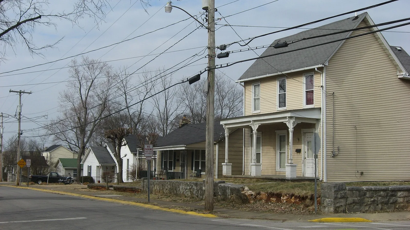
St. Joseph is a historic district northwest of downtown Bowling Green in ZIP code 42101, zoned for Parker-Bennett-Curry and Bowling Green High.
Last checked Oct. 16, 2026. Sources: the National Park Service’s National Register listing, the city’s school zone map and neighborhood groups list, the Kentucky School Report Card, the Zillow Home Value Index, Bowling Green Parks & Recreation and OpenStreetMap.
St. Joseph is a small residential district of older houses on the streets northwest of downtown, around Church Avenue. Visit Bowling Green lists it among the city’s four late 19th and early 20th century residential historic districts.
What this means for you
- Schools: Bowling Green Independent Schools: Parker-Bennett-Curry, Bowling Green Junior High and Bowling Green High School.
- Home value: Zillow’s typical value in ZIP code 42101 was $234,091 in September 2026.
- Interstate: the nearest I-65 interchange is Exit 26 (KY 234, Cemetery Road), about 3.5 miles east on the map.
Where it is
St. Joseph’s District was listed on the National Register of Historic Places on Nov. 26, 1980. The listing describes it as roughly bounded by Gilbert and Potter streets, Church Avenue and Brownslock Road. The City-County Planning Commission’s historic districts map shows it as a National Register district only; unlike downtown, College Hill and Upper East Main, it is not mapped as a local historic district.
The area is inside the city limits and in ZIP code 42101, according to the Census Bureau’s ZIP code areas. Main streets: Church Avenue, Brownslock Road, Jackson Street and West Main Avenue.
The city’s neighborhood groups list includes the Westside Neighborhood Association (St. Joseph). For neighborhood grants and watch programs, call Neighborhood & Community Services at 270-393-3000.
Schools
St. Joseph is in Bowling Green Independent Schools (270-746-2200). Every point we checked on the city’s school zone map fell in the Parker-Bennett-Curry zone. Check your own address before you sign a lease.
| School | Grades | 2024-25 rating |
|---|---|---|
| Parker-Bennett-Curry, 165 Webb Drive | K-5 | Orange (low) |
| Bowling Green Junior High | 6-8 | Green (high) |
| Bowling Green High | 9-12 | Green (high) |
Ratings are the overall color in the Kentucky Department of Education’s 2024-25 accountability file, from red (lowest) through orange, yellow and green to blue (highest). More in our schools guide.
Home values
Zillow’s Home Value Index for ZIP code 42101 was $234,091 in September 2026, up 0.2% from $233,593 in September 2025, according to the Zillow Home Value Index (Zillow Research). The citywide figure was $280,339. The index is a modeled typical value for the middle third of homes across the ZIP code, not a sale price. More in home prices.
Parks
- Roland Bland Park, 401 Center St., 6.25 acres, with the skate park, about half a mile away on the map.
- H.D. Carpenter Park (formerly Westend Park), 515 W. Main Ave., 2.5 acres.
- Hobson Grove Park, 1200 W. Main St., 222.6 acres, with the historic Hobson House, a nine-hole golf course and disc golf, a little over a mile away.
- James Hines Park, 1222 Boatlanding Road, 6 acres, with a boat ramp on the Barren River.
More in parks and trails.
Getting around
- Downtown: Fountain Square is about 0.7 mile away by road, measured on the OpenStreetMap road network.
- I-65: Exit 26 (KY 234, Cemetery Road) is the nearest interchange, about 3.5 miles east as the crow flies (exit numbers from OpenStreetMap).
- Nashville International Airport in Nashville, Tennessee, is about 76 miles away by road. That is a distance, not a drive time.
- Buses: GoBG Transit’s route map lists stops on Jackson Street at Church Street, on West Main Avenue by the Salvation Army, on Payne Street at Brownslock Road and on Brownslock Road at Scott Street. Call 270-393-3695, or see getting around.
Groceries and everyday stores
OpenStreetMap lists no supermarket in the district. The nearest:
- CVS Pharmacy, Kentucky Street, less than a mile away.
- Kroger, with a pharmacy, 350 U.S. 31-W Bypass, about 1.3 miles away.
More neighborhoods
St. Joseph is one of the areas in our Bowling Green neighborhoods guide. Nearby: downtown and Delafield.
Map data © OpenStreetMap contributors.
Frequently asked questions
Where is the St. Joseph neighborhood in Bowling Green?
St. Joseph’s District, on the National Register of Historic Places since Nov. 26, 1980, is roughly bounded by Gilbert and Potter streets, Church Avenue and Brownslock Road, northwest of downtown.
What elementary school serves St. Joseph in Bowling Green?
The city’s school zone map puts St. Joseph in the Parker-Bennett-Curry zone of Bowling Green Independent Schools. Older students go to Bowling Green Junior High and Bowling Green High.
What is the typical home value in the St. Joseph neighborhood?
St. Joseph is in ZIP code 42101, where Zillow’s Home Value Index was $234,091 in September 2026, up 0.2% on the year. It is a modeled typical value, not a sale price.
Is there a neighborhood association in St. Joseph?
The city’s neighborhood groups list includes the Westside Neighborhood Association (St. Joseph). Neighborhood & Community Services is at 270-393-3000.
Have your say